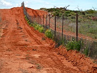
Driving distances Outback
How far is my planned Outback tour?
Driving Distances Outback is the section to plan your Outback Australia travel experience. Hopefully, you'll find your answer here. If not, don't hesitate to ask me!
The Australian Outback is such a huge place, it is hard to make a decision where to go at all, right? But that is your homework, you have to decide where to go. However, I am here to help you with your planning.
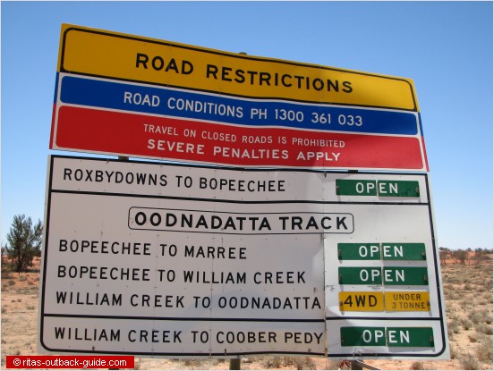
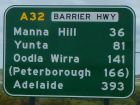
Please note: driving distances given in the tables below are only approximately. Every time when I plan a trip to Australia
I go crazy because diverse maps and sources always come up with different numbers.
Also, there are often several routes to choose from, hence the different numbers for distances betwees towns.
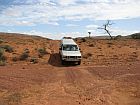
Most of the routes described on this page follow gravel roads. Conditions wary on these roads and tracks. So please get last minute information before you go and be well-prepared. Please check the Driving tips and individual track pages here in the Outback guide.
Capital Cities
Accommodation
Special Interests
- General Facts
- Australian States
- Photo Gallery
- Climate & Bushfires
- Australian Wildlife
- Australian Opal
Rent A Campervan
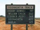
Adelaide to Marla via Oodnadatta Track (OT)
My favourite route! The distances in the chart are calculated without the detour to Wilpena Pound and the Flinders Ranges. When you go to Wilpena, you can continue to Blinman and through Parachilna Gorge to return to the Hawker - Leigh Creek main road.
Total distance: 1290 km
Driving time: 20 hours
Time required: 3 - 4 days minimum
| KM From / To | Adelaide | Hawker | Wilpena | Leigh Creek | Marree | Oodnadatta | Marla |
| Adelaide | --- | 396 | 451 | 551 | 669 | 1078 | 1290 |
| Hawker | 396 | --- | 55 | 155 | 273 | 681 | 893 |
| Wilpena | 451 | 55 | --- | 160 | 278 | 687 | 898 |
| Leigh Creek | 551 | 155 | 160 | --- | 118 | 527 | 738 |
| Marree | 669 | 273 | 278 | 118 | --- | 409 | 621 |
| Oodnadatta | 1078 | 681 | 687 | 527 | 409 | --- | 212 |
| Marla | 1290 | 893 | 898 | 738 | 621 | 212 | --- |
Highways used:
- Princes Hwy out of Adelaide to Crystal Brook
- Join the Main North Road at Laura, continue northbound via Melrose, Wilmington and Quorn to Hawker
- Barndioota Road to Marree
- Oodnadatta Track to Marla
When you finally arrive in Marla, you can go to Alice Springs (454km), Uluru / Ayers Rock resort (500km) or return to Adelaide via the Stuart Hwy (1077km)
Attractions along the way
- Flinders Ranges
- Historic Railway sites, Mound Springs along the Oodnadatta Track, unique Outback towns
- Lake Eyre
Birdsville Track & the far west of Queensland
The second chart covers South Australia's north-east, and Queensland's far west. Now you are going along the Birdsville Track into Outback Queensland.
Once you arrive in Birdsville coming from the south, the question is "where to go next?" This table and the third one below give you many suggestions.
| KM From / To | Marree | Mungerannie | Birdsville | Bedourie | Boulia | Mount Isa | Windorah |
| Marree | --- | 202 | 517 | 701 | 895 | 1205 | 888 |
| Mungerannie | 202 | --- | 315 | 502 | 696 | 996 | 689 |
| Birdsville | 517 | 315 | --- | 193 | 387 | 687 | 380 |
| Bedourie | 701 | 502 | 193 | --- | 194 | 499 | 411 |
| Boulia | 895 | 696 | 387 | 194 | --- | 304 | 605 |
| Mount Isa | 1205 | 996 | 687 | 499 | 304 | --- | 890 |
| Windorah | 888 | 689 | 380 | 411 | 605 | 890 | --- |
Highways used:
- Birdsville Track starting in Marree
- Birdsville & Diamantina Developmental Roads to Windorah
- Eyre & Diamantina Developmental Roads north of Birdsville up to Mount Isa
Attractions & more info
Matilda Highway & its Byways
This third chart of driving distances in the Outback covers the Matilda highway and its byways in Outback Queensland. Cloncurry, Winton and Longreach are the major towns along this route. Yes, it is a long way from Brisbane and the coast!
| KM From / To | Brisbane | Birdsville | Cloncurry | Longreach | Mount Isa | Windorah | Winton |
| Brisbane | --- | 1577 | 1691 | 1172 | 1808 | 1197 | 1348 |
| Birdsville | 1577 | --- | 803 | 691 | 686 | 380 | 745 |
| Cloncurry | 1691 | 803 | --- | 519 | 117 | 830 | 343 |
| Longreach | 1172 | 691 | 519 | --- | 636 | 311 | 176 |
| Mt. Isa | 1808 | 686 | 117 | 636 | --- | 904 | 460 |
| Windorah | 1197 | 380 | 830 | 311 | 904 | --- | 487 |
| Winton | 1348 | 745 | 343 | 176 | 460 | 487 | --- |
Highways used:
- Matilda Highway from Cunnamulla to Cloncurry
- Thomson Developmental Roads Longreach to Windorah
- Kennedy Developmental Roads Winton to Boulia
Attractions & more info


